


Page 23 - 6th NamamiGange NewsLetter
P. 23
Leveraging Technology for Ganga Rejuvenation
23
LiDAR & GIS technology to strengthen Namami Gange programme
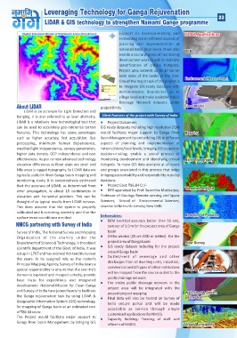
About LiDAR support in decision-making and LiDAR Applications
embedding GIS in different aspects of
LiDAR is an acronym for Light Detection and planning and implementation at DEM
Ranging. It is also referred to as laser altimetry. national/state/ local levels. It will also Environmental Assessment
LiDAR is a relatively new technological tool that enable a sound process of monitoring Flood Model
can be used to accurately geo-reference terrain development work as well as real time Mapping
features. This technology has some advantages identification of critical hotspots. Micro Topography
such as higher accuracy, fast acquisition, fast Project area extends up to 10 km on Viewshed Analysis
processing, minimum human dependence, both sides of the banks of the river. Modelling of Pollution
weather/light independence, canopy penetration, One of the major task of the project is River Survey
higher data density, GCP independence and cost to integrate GIS ready database with Sewer & Manhole Survey
effectiveness. As per current advanced technology Administrative Boundaries up to Watershed & Stream
elevation differences in flood plain are small and village level and make available Public Delineation
hilly areas is rugged topography. So LiDAR data are Drainage Network datasets under Urban Municipality
typically useful in River Ganga basin mapping and project limits.
monitoring study. It is conservatively estimated
that the accuracy of LiDAR, as determined from Silent Features of the project with Survey of India
error propagation, is about 15 centimeters in
elevation and horizontal position. This can be Project Outcomes:
thought of as typical results from LiDAR surveys. GIS ready datasets including high resolution DEM
This does assume that the system is properly would facilitate major support to Ganga River
calibrated and functioning correctly and that the Basin Management by embedding GIS in different
surface terrain conditions are ideal. aspects of planning and implementation at
national/state/local levels; bringing GIS support in
NMCG partnering with Survey of India decision-making; enable a sound process of
monitoring development and identifying critical
Survey of India, The National Survey and Mapping hotspots. To make GIS data available at all levels
Organization of the country under the and groups associated in this process that helps
Department of Science & Technology, is the oldest bringing accountability and responsibility in policy
scientific department of the Govt. of India. It was decisions.
set up in 1767 and has evolved rich traditions over Project Cost: `86.84 Cr./-
the years. In its assigned role as the nation's DPR appraised by Prof. Saumitra Mukharjee,
Principal Mapping Agency, Survey of India bears a Professor of Geology Remote sensing and Space
special responsibility to ensure that the country's Sciences, School of Environmental Sciences,
domain is explored and mapped suitably, provide Jawaharlal Nehru University, New Delhi
base maps for expeditious and integrated
development. National Mission for Clean Ganga Deliverables:
and Survey of India have joined hands to facilitate DEM (vertical accuracy better than 50 cm),
the Ganga rejuvenation task by using LiDAR &
Geographic Information System (GIS) technology, contour of 1.0 m for the project area of Ganga
for mapping of Ganga basin at an estimated cost basin
of `86.84 crore. Ortho photos (25 cm GSD or better) for the
The Project would facilitate major support to project area of Ganga basin
Ganga River basin Management by bringing GIS GIS ready dataset including for the project
area of Ganga basin
Outlet/vent of sewerage and other
discharges from all dwelling units, industrial,
commercial and all types of other institutions
will be mapped from the source outlet to the
public drainage network
The entire public drainage network in the
project area will be integrated with the
present project mapping
Final data will also be hosted on Survey of
India secure portal and will be made
accessible as service through simple
customized applications for NMCG
Capacity Building: Training of staff and
officer's of NMCG

